2023 was a busy year for The Surveying Company. Our UAV dedicated company arm, Drone IT, is now fully up and running. We are a small, but dedicated team with a wide range of expertise, and a passion for drones. Our team consists of three pilots, with over 16 years experience between us. Our specialty is high accuracy, high resolution aerial surveying and 3D modelling, however we also produce aerial video and photography, carry out inspection work, and use multispectral sensors to map orchards, produce health maps and enable growers to optimise their yields.
The last quarter of 2023 has seen us travelling all over the North Island for both survey and drone work.
Our team did a long stint down south in Eketahuna, Pahiatua and Dannevirke, carrying out both aerial and terrestrial surveys of waste water treatment plants and dams. A lot of this infrastructure is ageing and in need of maintenance. Often the best way to get a full picture of where things are at is to use a UAV to capture the whole site from above. What the UAV can’t ‘see’, is filled in by a GPS ground topographical survey.
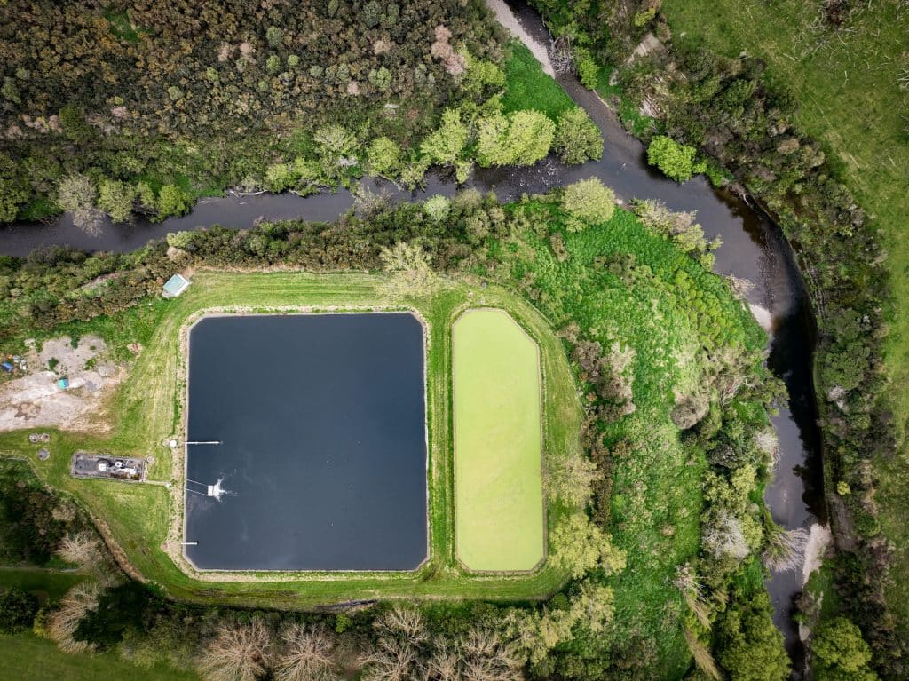
Local councils will use the data we provide for engineering design and future maintenance plans.
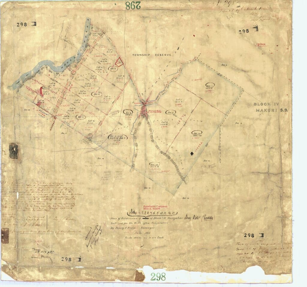
Part of the WWTP surveys included marking the site boundaries and updating survey records to reflect the true locations of these boundaries. Survey plans in these areas are very old, some being over well over 100 years old, so it can be tricky to calculate and place boundaries accurately.
Our team spent a week in Tauranga carrying out multispectral surveys for Aerobotics. Our multispectral sensor is able to measure bands of light not seen by the human eye, including Infra Red, Near Infra Red, Red Edge and Thermal. These light bands give an early indication of plants that are stressed, either by water stress (irrigation issues), disease or nutrient deficiencies. Being able to detect these issues early gives the grower ample time to rectify the issues, and improve overall yields. With increased regulation on the industry, combined with the drive to use resources like water, fertilizer and sprays more efficiently, these health indices are integral to growers being able to achieve higher yields with fewer inputs.

Quarries are the perfect application for drone surveys. We used our UAVs to survey a local quarry, providing them with an up-to-date, survey accurate aerial map and model which they use for future planning and plant movements. We generated a 3D model of the quarry, and used this to design a future quarry pit expansion. The design included ramps and benches, and enabled the calculation of volumes available for extraction. We also provided full sets of quarry plans to accompany a resource consent for further extraction.
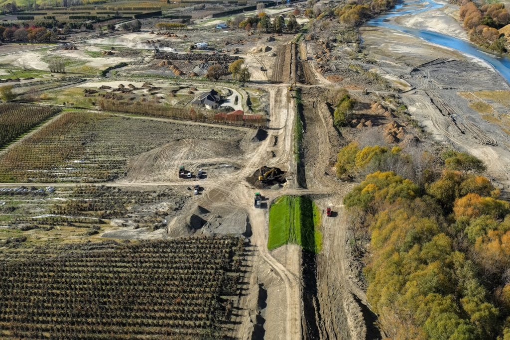
Immediate post cyclone cleanup and repair work is coming to an end now. We have been supporting local councils, engineers and geotechnical consultants by providing them with timely, accurate, high resolution aerial surveys of stop-banks, landslips, erosion, and scoured areas. As the high priority repair work concludes, we now move into the long term work, building flood resilience into our local area.
Our pipleline of work for 2024 will see us remaining busy for the foreseeable future, however, we would live to chat to you about your projects. Don’t hesitate to get in touch if you have a job, site, or project requiring drone or survey information.